Wednesday, July 31, 2013

Day 77: Custer, SD (cont.)

Still with Stacy and Jack in Custer, SD:

Today was a sightseeing day. The four of us headed out to Jewell Cave National Monument. The tours of the cave were sold out for a couple of hours so we booked a mid-afternoon tour and left to tour Custer State Park and get some lunch.

Custer State Park is supposed to have thousands of bison and, supposedly, they are to be found on the scenic wildlife loop. We saw some wild burros and a couple of deer.

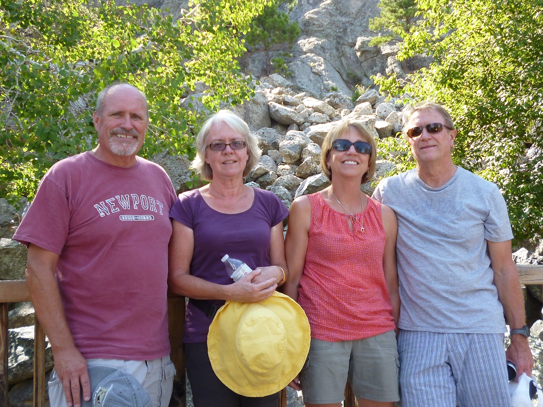
Kristen snapped the rest of us at a scenic point:

Wild burros (not native - ancestors escaped captivity):

After a good lunch and an exploration of Custer we returned to Jewell Cave and went on the tour. Jewell Cave is the third longest cave in the world and, much to our satisfaction, is much more like Carlsbad Caverns than it is like Mammoth Cave. It's much wetter with a lot more limestone which leads to a lot of more interesting rock formations. We were very impressed.


This formation is called "bacon" and it really looks like it:


-J-

Tuesday, July 30, 2013

Day 76: Custer, SD

Stop 46: Custer, SD

Today was the long anticipated intersection of my sister Stacy and her husband Jack's Eastbound trip with our Westbound trip. They're going to travel the US for a year and left their home near Portland about a month ago ( follow their journey at jackstacy.blogspot.com).

Here's a picture of the 4 of us:

Today's 116 mile trip followed SD-44 through the Buffalo Gap National Grassland South of Badlands National Park. Beautiful country and we almost had the road to ourselves.

The Sturgis motorcycle rally doesn't start until August 5th but the bikers are out in force.

Along SD-44:

Lining the streets in Hill City:

We arrived at the RV park first and found that the pull-through sites that they had reserved for us were right on the highway, dusty and treeless. I made an executive decision and had us moved to a pair of back-in sites down in the woods. Backing in was an unwelcome challenge for both trailers but we got it done.

As soon as we were set up and had caught up a little, we took off for some sight seeing. First stop was the Crazy Horse Memorial. We were last there in 2007 and we honestly didn't notice much progress.

The bikers were out in force there as well.
The Memorial. That's a bulldozer on the end of what will be an outstretched arm:

A model of what the Memorial will look like:

Another model of the Memorial and its surroundings
(I wanted Kristen to loom like Godzilla but no deal):

Next stop, Mount Rushmore:


Here's the 4 of us at Mount Rushmore:

Finally, the 2 trailers:
 
-J-


Monday, July 29, 2013

Day 75: Interior, SD

Stop 45: Interior, SD

145 miles today to this tiny town on the edge of Badlands National Park. Most of today's trip was under heavy clouds, though you'd never know it from any of these pictures. I think that the weather is finally turning summerlike again. I haven't mentioned it but,the last couple of days, we've actually seen high temperatures that were the lowest for the date in recorded history (they broke into the 60's but barely). We've been using the heater at night. By the end of today's trip, it was sunny and the temperature was close to 90.

Badlands National Park is surrounded by the Buffalo Gap National Grassland (who knew that we had national grasslands?).This is a tiny bit of it.

To get to our park, we had to pass through the National Park. The pullouts are a little difficult with a trailer so we got settled in and then returned to the park sans trailer.

Badlands made us think of what Bryce Canyon might look like without the color and after another thousand years of erosion. Here's a few pictures.

Our RV park is on the White River which is marked by the trees in the distance.


On our way in, we'd noticed a place that had a prairie dog village, so we had to return to see it. Here's one popping up in the parking lot in front of Kristen.


We'd also passed by a sod house so we stopped to have a look.


Here's our home for he night. We're right next to the White River but we really can't get near it (too much brush). From what we've seen, there's very little water and what there is, really is white. All of the soil here is white so it makes complete sense that the river runs with white silt. There are indications that, at times, the river is quite a bit larger,

One other thing that I wanted to mention is the cicadas. This has been the year of the cicadas and we've heard them in many places. They are the loudest here of any place that we've been. We're surprised to even find cicadas in South Dakota.

-J-

Sunday, July 28, 2013

Day 74: Oacoma, SD

Stop 44 / State 27: Oacoma, SD

We had a longer trip than usual today, 229 miles. One thing that I've been intending to mention is the increasing frequency of large motorcycles. The Sturgis motorcycle rally starts up in a few days and the motorcycle world is moving in that direction.

As I mentioned in the heading, we're in South Dakota now. Just so you know where Oacoma is, it's kind of a suburb of Chamberlain (which you might find on a good map). The 2 towns are on opposite sides of the Missouri River.

I mentioned yesterday that the terrain was getting flatter and flatter. Today, it finally reached flat. Our GPS reports the elevation and we were surprised to notice today that we are higher at home than we are here. Here are some pictures that Kristen took of the flatness.


We don't know what this cow sculpture was all about but Kristen really liked it.

When we were almost to our destination today, we came to a rest stop that included a Lewis and Clark point of interest so, of course we pulled off. The rest stop was at the site of Camp Pleasant, where the Corps of Discovery spent a week on their westward trip in 1804. They stopped their again on the return trip in 1806..

You might miss it in the picture above so here's a better shot of that sign that was in the background.

And here's the view of the Missouri from Camp Pleasant. We didn't realize it at the time but our campground is on the opposite bank, just to the left of this picture.

Here we are in the campground, right on the banks of the Missouri. Well actually, I-90, which passes about 100 feet in front of our truck, is right on the banks of the Missouri. In the picture, that's the Missouri right between the pavement and the distant bank.
 
I had a bit of a panic this afternoon. We're going to be meeting with my sister Stacy and her husband Jack in Custer, SD on July 30th for 2 nights. That particular reservation needed to be made by phone and no email confirmation was received. Kristen was looking through my hand written reservation documentation this afternoon and asked "Why does this say that it's for 1 night?". I looked at it. That's what it said but it also showed the per night charge and a 2 night total. Then I noticed that it said "7/29 for 1 night". I obviously needed to call the park but we've had no cell reception since we hit South Dakota and the pay phone next to the park office has been vandalized. I ended up borrowing a cellphone from the woman at the desk in the office. The park in Custer had no record of my name for the 29th or 30th and my reservation number didn't exist. I ended that call with a promise to call them back after I'd done a little bit more research. I discovered that the reservation number that I'd written down for Custer was also my reservation number for Yellowstone. Fortunately, I've logged all of the important data into a spreadsheet. Checking that, I came up with a different confirmation for Custer. I called Custer back. The new number was good and there was no problem the reservation was exactly as it should be. The reason that they couldn't find the reservation the first time was that they had misspelled my name. Whew!
 
-J-

Saturday, July 27, 2013

Day 73: Jackson, MN

Stop 43: Jackson, MN

Today's 140 mile trip took us across a lot of beautiful farmland. The corn goes on for miles. The only time that it's not corn is when it's soy beans, the alternate crop that, apparently, restores the soil so that they can grow more corn. The rolling prairie that we saw yesterday seems to be flattening out as we move west.

As we normally do on travel days, we stopped at a rest area so that we could eat lunch back in the trailer. This rest stop had signs directing us to a "Golden Spike Monument". We had to see what that was about. Didn't realize that they even used spikes in building interstates.

Once we were settled, we needed to make a Walmart run. The closest was in Spirit Lake, IA. We won't be adding Iowa to our state count (since the trailer wasn't in tow), but here's the sign anyway.
 
Along the way to and from Spirit Lake, we passed a drive-in theater at the intersection of 2 small highways out in the corn. On the way to, we decided that it must be an abandoned relic. Coming from, we examined it more closely. Sure enough, the weedy lot included a snack bar / projection booth, a screen, and a small marquee that said that Wolverine is showing nightly. Kristen is kicking herself that she didn't get a picture.
 
Since there was no "Welcome to Minnesota" sign yesterday (or maybe we missed it), we decided to take advantage of our second chance coming back from Iowa. I nicknamed Kristen "Quick Draw" the other day. I may need to change that to "Slow Hands". In all fairness, this sign was well off the road and blended with the background perfectly (i.e., camouflaged sign). We were looking for it, knew where it had to be and still almost missed it entirely.


Finally, our home for the night:

-J-